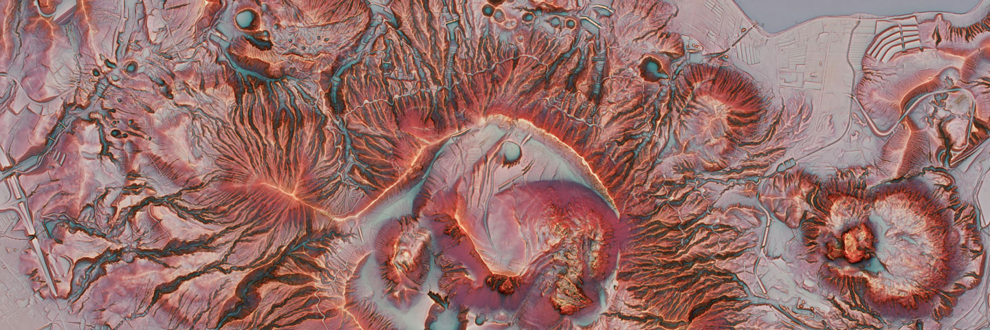
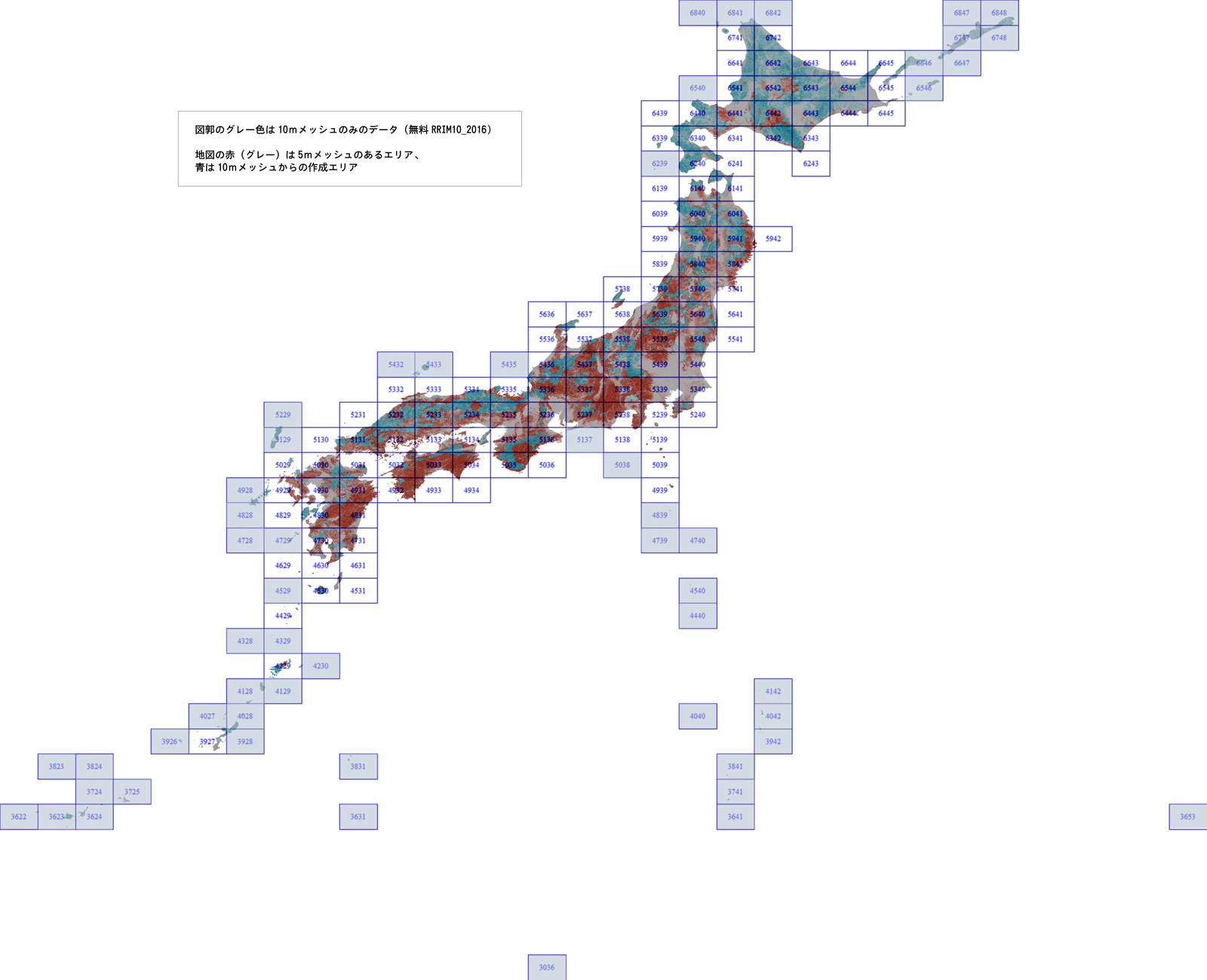
Good for looking mountainous aera.
Base Map Information 10m mesh DEM of Geospatial Information Authority of Japan is used.
Price
Free of Charge (from April 1st, 2017)
Specifications
Data Provider
Asia Air Survey, Co., Ltd.
Data Source
Base map Information 10m DEM, 2008-2009 Published by Geospatial Information Authority of Japan Confirmation Work: Dec., 2015
Last Update: Jan., 2010
Data Format
TIFF Raster with World File, tfw
Geodetic Datum
JGD2000
Coordinate System
Lon/Lat
Coordinate Information
defined by World File
Available Area
All Over Japan
Provided Unit
1st Order Grid Square Code
Resolution
0.4 second / pixel
Update Frequency
NA
Misc.
Not so good Looking at Flat Area Approval Number 2016 #1285, Geospatial Information Authority of Japan
Dealers
Geospatial Information Center,MAPSHOP
Click here (Both web-sites are external)
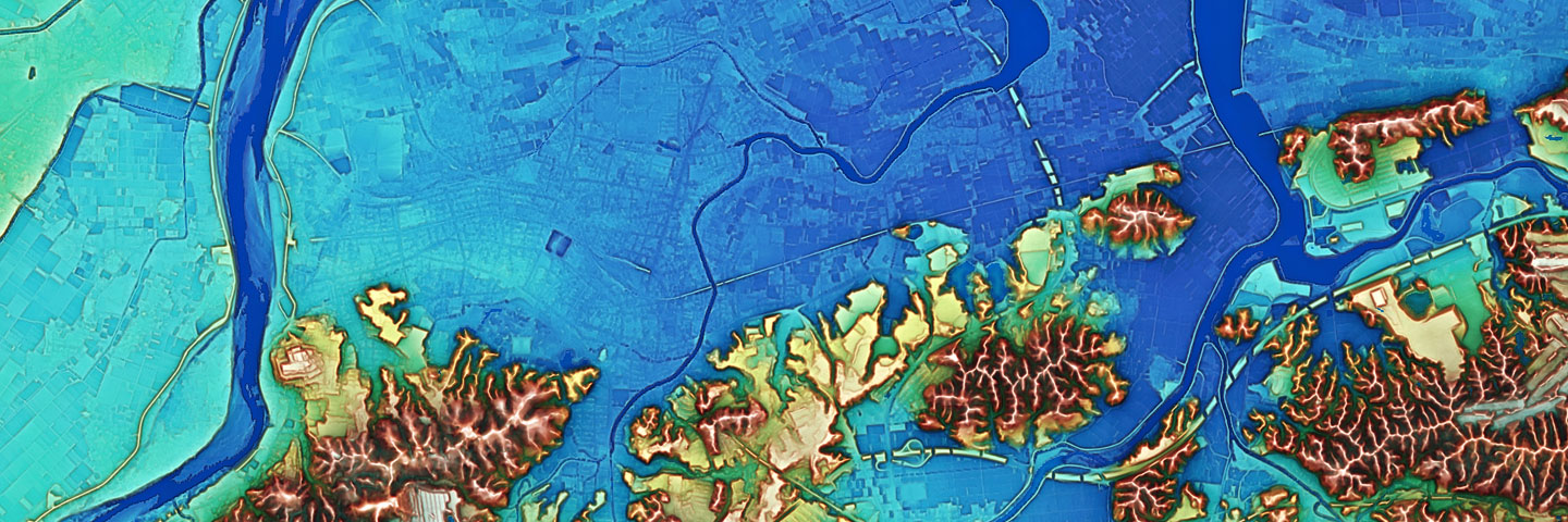
RRIM5+ (10m+5m Hybrid)
Hybrid map products of RRIM10_2016 (10m Mesh) and RRIM5 (5m Mesh). Topography of city area can be recognized.
Price
30,000JPY (excluding tax) / Mesh
Specifications
Data Provider
Asia Air Survey, Co., Ltd.
Data Source
Base map Information 10m DEM, 2008-2009
Published by Geospatial Information Authority of Japan Confirmation Work: Dec., 2015, Last Update: Jan., 2010
Base map Information 5m DEM,
Published by Geospatial Information Authority of Japan Confirmation Downloading Work: Oct., 2016
Data Format
TIFF Raster with World File, tfw
Geodetic Datum
JGD2000
Coordinate System
Lon/Lat
Coordinate Information
defined by World File
Available Area
All Over Japan
Provided Unit
1st Order Grid Square Code
Resolution
0.2 second / pixel
Update Frequency
Corresponding updates by Geospatial Information Authority of Japan
Misc.
Seam lines might be seen in case of connection between 10m and 5m.
The connection can be seen here. Approval Number 2016 #1285, Geospatial Information Authority of Japan
Dealers
Geospatial Information Center,MAPSHOP,and RRIM Web Order Service (AAS)
Click here (Geospatial Information Center and MAPSHOP are external web-sites)
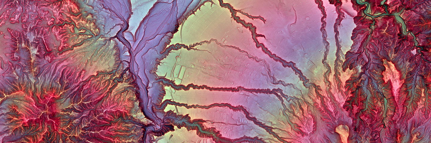
Customized products fitting what the customers want to see.
Base map Information 5m DEM, Published by Geospatial Information Authority of Japan is used
Price
Quoted as needed
Specifications
Data Provider
Asia Air Survey, Co., Ltd.
Data Source
Base map Information 5m DEM,Published by Geospatial Information Authority of Japan Confirmation Downloading Work: Oct., 2016
Data Format
TIFF Raster with World File, tfw
Geodetic Datum
JGD2000
Coordinate System
Lon/Lat
Coordinate Information
defined by World File
Available Area
The area where Base map information 5m DEM is available
Provided Unit
1st Order Grid Square Code
Resolution
0.2 second / pixel
Update Frequency
Corresponding updates by Geospatial Information Authority of Japan
Misc.
Approval Number 2016 #1285, Geospatial Information Authority of Japan
Base map Information 10m DEM, 2009 And 1:25,000 topographical map Published by Geospatial Information Authority of Japan
Data Format
Jpeg Raster with World File, jpw*Seven-Eleven net printing output is PDF
Geodetic Datum
WGS84
Coordinate System
Lon/Lat
Coordinate Information
defined by World File
Available Area
Hundred famous mountains in all over Japan
Provided Unit
ex-Japan Geodetic Datum 2nd Order Grid Square Code,(Conformity to 1:25,000 Topographical Map)iAAS Discretion (Hundred famous mountains in Japan)
Resolution
0.4 second / pixel, AAS Discretion
Update Frequency
NA
Misc.
Trademark #5278733, Approval Number 2009 #66, Geospatial Information Authority of Japan
Dealers
MAPSHOP, Seven-Eleven Net Print
Click here (Both web-sites are external)
Terms of Use
By using the products, you agree to be bounded by[RRIM Product License Agreement]between you and AAS. Please read these terms of use thoroughly and make sure you understand them prior to your order,
In case of Direct Purchases from AAS
Order
Orders by any organizations, Schools, or individuals will be accepted.
Please readProtection Policy of Personal Information. And quote or inquire using “Ordering Inquiry Form”.
Delivery
Delivery will be done after receipt of all payment.
When requesting invoices for companies or organizations, please let us know.
Delivery way: Data transmitting service or CD-R sending by mail.
Cost estimation
Type a numeric value into each text box and then click the Calculate button.


