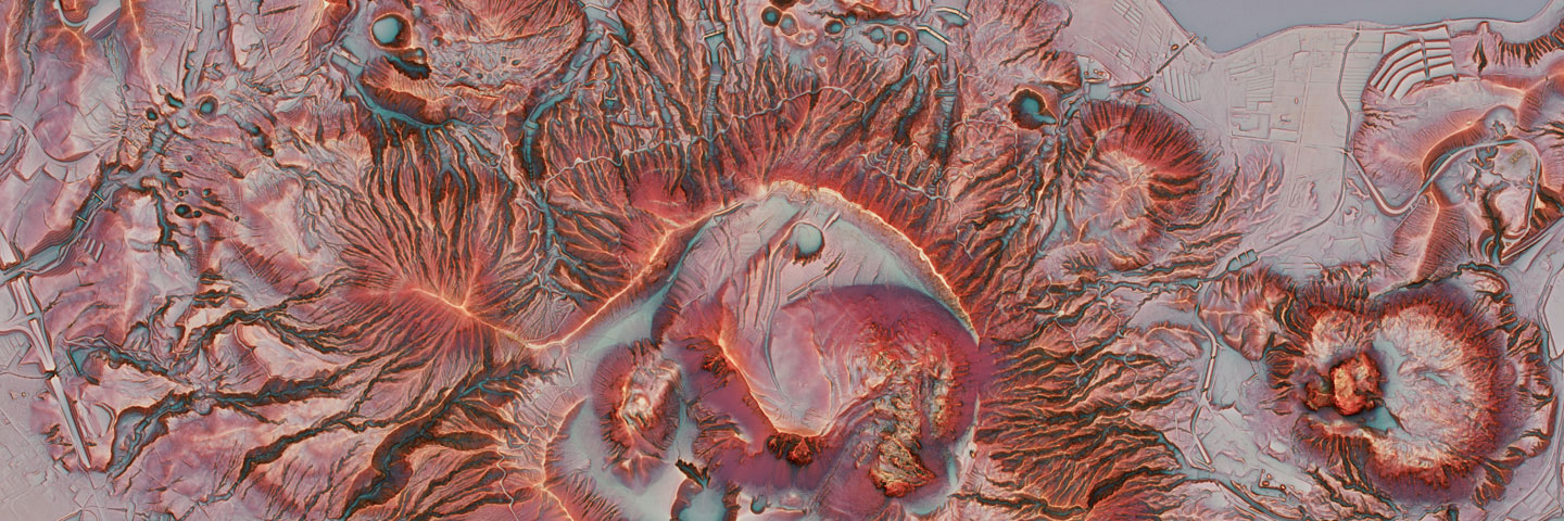
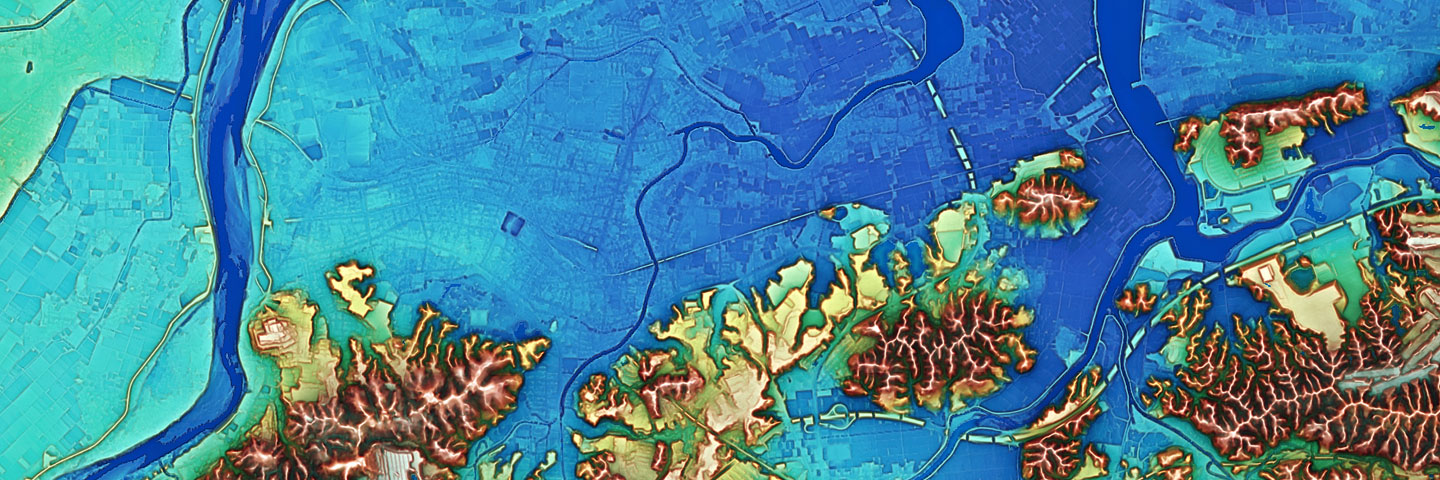
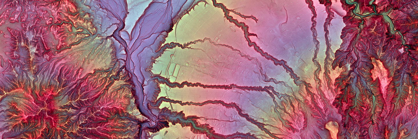
Red Relief Image Map (RRIM) is a completely new 3D visualization method for topography using chroma of red color to slope and brightness of red color to ridge-valley value calculated from DEM.
The RRIM has overcame the shortness of traditional visualization methods, such as weakness for scaling, light direction dependence, necessary of stereoscope and filtering, can express details of topography by single image map.
For make the RRIM, we use the patented technology holed by Asia Air Survey, Co., Ltd., registered in Japan as well as US, China, and Taiwan.
The RRIM can be used for investigation of topographical features such as volcano, landslide and fault, also useful for remains and ancient tomb investigation, tourist guide map and mountain climber’s map etc. [patent information]
The RRIM was originally invented in 2002 for visualize the result of airborne LiDAR measurement. The airborne LiDAR measurement can get a large amount of data. However, in the acquired data set, conventional contour map only can express the data which coincide with the specific contour interval. On the other hand, when using a large amount of data to create contour map, the distance between contours will be too narrow and very hard to express the ground surface with unevenness.
Under this situation, we express the ground surface as “plan” by “chroma and brightness of red color” instead of the “line” of contour. Using whole digital elevation data, the method can express the details of ground surface, available for very easy to understand the real topographical features of the site. Moreover, differ to aerial photos which need a pair for stereographic vision, this method use only single map to express 3D visualization.
In the RRIM, the ground surface is expressed as the steeper the redder, bright on ridges and dark in valley. The RRIM can express any scale of topography, especially very powerful to express micro topographical features.
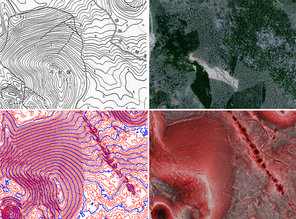
Comparison of topographical expression method (Chiba et al., 2011)Upper left: contour map; Upper right: Ortho image; Lower left: Contour map from airborne LiDAR; Lower right: RRIM
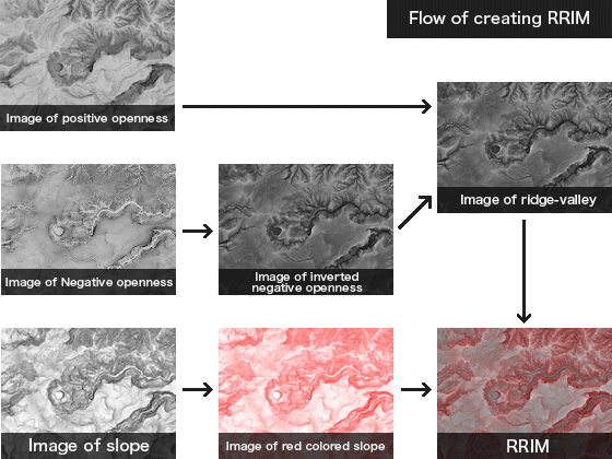
For create the RRIM, slope gradient and positive openness and negative openness were calculated from DEM, ridge-valley value is calculated from positive and negative openness.
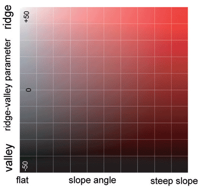
Adjustment diagram of the Red Relief Image Map

Tree created from airborne LiDAR measurement and detection of slope failures
Small landslides which difficult to be detected from aerial photos due to tree shadow, could be interpreted very clearly using the RRIM.
1) Takashi TSUCHIDA ,Yoshimitsu TAKEDA, Kiichiro OGAWA and Shinji NAKAI (2010): Preliminary report of landslide disasters in Shobara city, Hiroshima Prefecture, Japan triggered by the heavy rain storm on July 16th, 2010, Journal of JSNDS, 29-2, pp.245-257. 2) Masato NISHI, Shinyichiro HAYASHI, Takao YAMAKOSHI and Takeshi SHIMIZU (2010): The sediment disaster in Shobara city, Hiroshima, induced by July 16 2010 heavy rain by seasonal rain front, 52-9, pp.6-7.